Most Beautiful Chinese Mountains You Can See on Silk Road Journeys
The Silk Road was never just a line on a map. It was a journey shaped by mountains that rose suddenly from deserts and stretched across the horizon without end. These Chinese mountains did more than create scenery. They controlled movement, guided trade, and defined where cultures met and grew. From the high walls of the Qilian range to the remote edges of the Kunlun and Altun Mountains, every stretch of land tells a story. This is where travel becomes more than distance. It becomes a connection between landscape, history, and experience.
Why Chinese Mountains Matter on the Silk Road
Chinese mountains played a direct role in shaping how the Silk Road developed. They acted as both barriers and natural pathways. Travelers could not move freely in every direction, so routes formed along valleys, passes, and edges of mountain ranges. These paths guided merchants, monks, and caravans across long distances. Instead of blocking movement completely, mountains controlled it. This is why many Silk Road routes follow the same narrow corridors between high terrain and open desert.
Mountains also influenced where people lived and built cultural centers. Monasteries often appeared in quiet mountain areas where monks could study and practice in isolation. Settlements grew near passes and water sources where travelers stopped to rest and trade. Over time, these places became points of cultural exchange. Ideas, beliefs, and traditions moved along these same routes.
Most Beautiful Chinese Mountains on Silk Road Journeys
The whole Silk Road journey is full of beautiful scenes. But these mountains stand out above all others.
Qilian Mountains – The Highland Barrier of the Silk Road
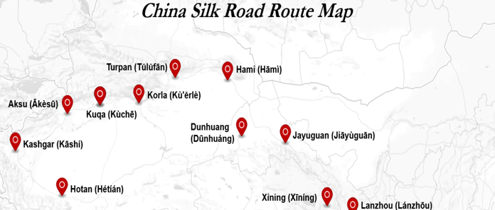
The Qilian Mountains form one of the most important natural features along the Silk Road. They stretch between Qinghai and Gansu and run along the southern edge of the Hexi Corridor. This position made them a natural boundary and a guide for movement. Ancient routes passed along their base instead of crossing them directly.
The range extends for around 800 kilometers, acting as a monumental divide between the Tibetan Plateau and the Hexi Corridor—the legendary artery of the ancient Silk Road—before giving way to the vast deserts further north.
The scenery here changes quickly across the range. Snow-covered peaks rise above wide grasslands and open valleys. Some peaks reach over 5,500 meters, with even higher summits further south. Glaciers and mountain streams flow down from these heights and support life in the Hexi Corridor.
These water sources made settlement and agriculture possible in nearby regions. Passes such as Biandukou allowed controlled movement between areas, linking Qinghai and Gansu. The Qilian Mountains are not just visually striking. They shaped how people traveled, where they settled, and how the Silk Road developed across northern China.
Kunlun Mountains – The Edge of the Plateau
The Kunlun Mountains form one of the longest mountain ranges in Asia, stretching for more than 3,000 kilometers across western China. They run along the northern edge of the Tibetan Plateau and form a natural boundary south of the Tarim Basin.
This position placed them along the more remote Silk Road routes, especially those moving around the Taklamakan Desert. Travelers did not cross these mountains easily. Instead, they moved along their edges, using routes shaped by terrain and water sources.
Over time, the Kunlun became known not only for their scale but also for their importance in guiding movement across remote regions. The landscape here feels harsh and distant. High peaks rise above dry basins and desert plains, with some summits reaching over 7,000 meters.
Rivers such as the Karakash and Yurungkash flow from these mountains into oasis regions, supporting life in otherwise difficult conditions. The area has very few roads even today, which shows how isolated it has remained. This isolation helped preserve its natural and historical character.
Along the Silk Road, the Kunlun Mountains marked the edge of the plateau and the limit of easier travel. Beyond them, conditions became more extreme, and routes became more challenging for traders and travelers.
Altun Mountains – Desert Meets Mountains
The Altun Mountains, also known as Altyn-Tagh or “Gold Mountains,” form a natural boundary between the Tarim Basin and the Tibetan Plateau. They stretch across northwestern China and connect with other major ranges like the Kunlun and Qilian Mountains.
This position made them important along the Silk Road, where routes passed along their northern edge through the Hexi Corridor. At certain points, the Silk Road even split into different paths, with one route following the southern side of the Tarim Basin near these mountains.
Instead of being a direct crossing point, the Altun range shaped how travelers moved around harsh terrain. The landscape here shows a strong contrast between mountains and desert. Peaks rise from dry land with very little water, creating wide open views of rock, sand, and sky.
Some peaks reach over 6,000 meters, while lower sections form basins and salt lakes in between. The region remains dry, with few rivers and limited vegetation, which adds to its remote feeling.
This isolation has kept the area less explored compared to other Silk Road regions. Traveling through or alongside the Altun Mountains gives a clear view of how nature shaped the route, where mountains and desert meet in one of the most dramatic parts of the Silk Road.
Mountains Around Xining – Gateway Landscapes
The mountains around Xining mark the transition from central China into the Tibetan Plateau. This region has long served as an entry point for travelers moving west along the Silk Road.
Instead of sharp peaks, the landscape here opens into rolling hills, wide valleys, and highland terrain that gradually rises in elevation. These natural features made Xining an important stop where routes adjusted before entering the more demanding plateau and desert regions.
The area also carries strong cultural importance. Monasteries such as Kumbum were built within these landscapes, creating centers of learning and religious practice.
Settlements grew nearby, supported by travelers, trade, and local communities. This connection between land and culture remains visible today. The mountains around Xining do not just shape the scenery. They shape how people live, travel, and connect across this part of the Silk Road.
How Mountains Shape the Silk Road Experience
Mountains change how the Silk Road feels from one region to another. The journey does not stay the same. Landscapes shift from dry desert plains to rising peaks and high valleys. These changes create a natural rhythm that travelers experience over time. Movement slows down as terrain becomes more complex. This is why the Silk Road was never just a straight path but a route shaped by land itself.
Train journeys follow this rhythm closely, allowing travelers to see these transitions clearly without rushing past them. Watching the land change through wide windows gives a better sense of how geography shaped travel and trade.
Experiencing the Chinese Mountains on Silk Road Train Routes
Train travel offers one of the most comfortable ways to see the Chinese mountains along the Silk Road. Panoramic windows allow clear views of valleys, peaks, and open landscapes without interruption. Travelers do not need to hike or climb to experience these regions.
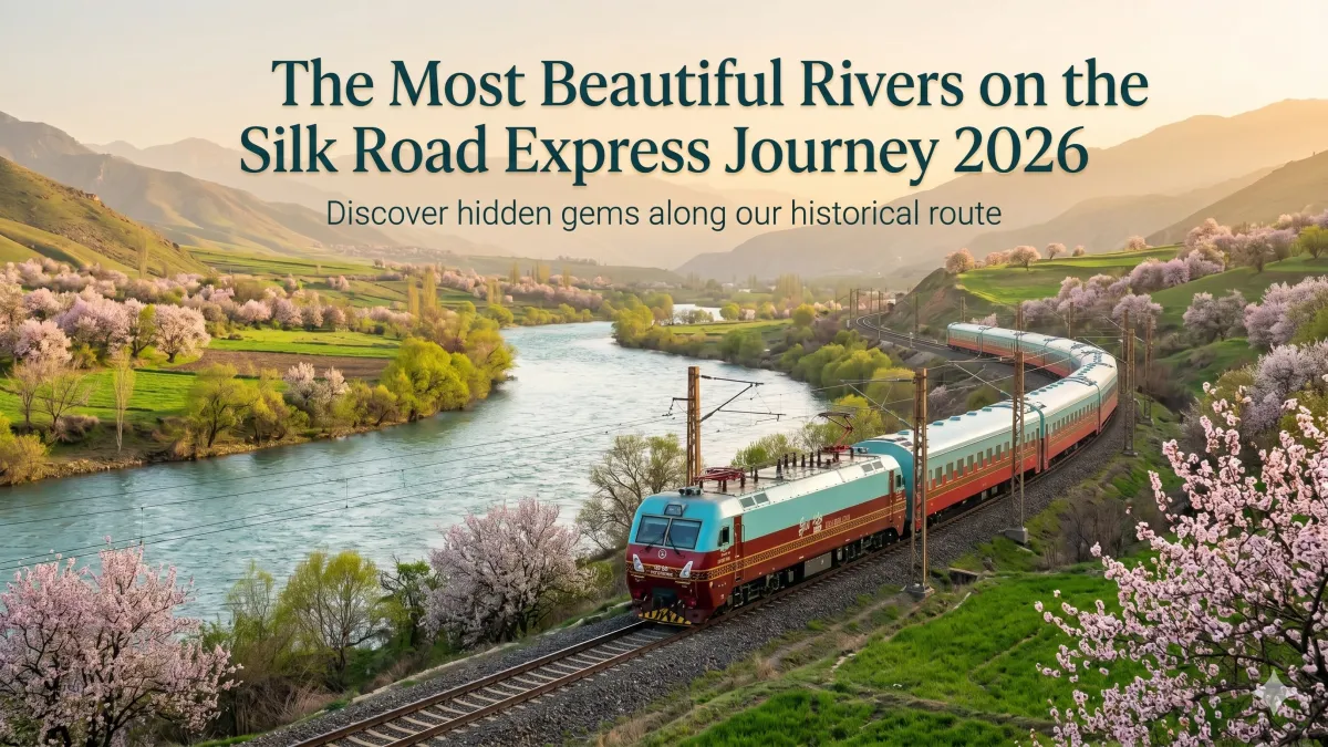
The journey remains steady and relaxed while the scenery changes outside. Routes like the Silk Road Express pass through key mountain regions, giving direct access to areas that would otherwise be difficult to explore.
Best Time to See Chinese Mountains on Silk Road Journeys
Spring and autumn offer the best conditions for viewing Chinese mountains along the Silk Road. The weather remains mild, which makes both travel and sightseeing easier. Clear skies improve visibility, especially in highland and desert regions where light plays an important role. These seasons also avoid the extremes that can affect travel plans.
Winter brings heavy cold in mountain areas, while summer heat can become intense in nearby desert zones. Choosing the right season allows travelers to enjoy the landscapes without discomfort. Light during spring and autumn also improves photography, as softer tones highlight the natural details of mountains and valleys.
Travel Tips for Exploring Chinese Mountains
Travelers should prepare for changing conditions when visiting mountain regions. Altitude and temperature can shift quickly, even within a single day. Packing layers helps adjust to these changes without difficulty. Comfortable shoes are also important for walking at cultural and scenic sites. Respect for local traditions matters in mountain areas, especially near monasteries and religious locations. Visitors should follow basic etiquette and remain aware of their surroundings.
Conclusion
The Silk Road was never just a line on a map. It was a journey shaped by mountains that rise suddenly from deserts and stretch across the horizon without end. These Chinese mountains did more than create scenery. They controlled movement, guided trade, and defined where cultures met and grew. From the high walls of the Qilian range to the remote edges of the Kunlun and Altun Mountains, every stretch of land tells a story. This is where travel becomes more than distance. It becomes a connection between landscape, history, and experience.
FAQs
What Chinese movement shows travelers among mountains and streams?
The “travelers among mountains and streams” theme comes from traditional Chinese landscape painting. It reflects the idea of harmony between humans and nature, where mountains represent strength and balance while travelers appear small within the vast landscape.
How did mountains and deserts help Chinese civilization develop?
Mountains and deserts acted as natural protection from invasions and helped define regional cultures. At the same time, they guided trade routes like the Silk Road, allowing controlled exchange of goods, ideas, and traditions across regions.
What is the best way to explore Chinese mountains along the Silk Road?
The best way is through train journeys like the Silk Road Express, which offer scenic views, comfortable travel, and access to remote mountain regions without the need for difficult hikes.
Which Chinese mountains are most important on the Silk Road route?
The Qilian, Kunlun, Altun Mountains, and the highland landscapes around Xining are among the most important, as they shaped routes, settlements, and cultural exchange along the Silk Road.